In the class performed in UPEL University, on December 2006, this were the cities that the students and the professors discussed about.
Madrid: Is the capital of Spain and the largest city in the Iberian peninsula. It is also the third most populous city in the European Union after London and Berlin. Its effect on world history and politics, as well as its major cultural influence, has ranked Madrid one of the main global cities of the world. Madrid is also the largest city in Spain, as well as in the province and the autonomous community of the same name. It is located on the river Manzanares in the center of the country, between the autonomous communities of Castilla-León and Castilla-La Mancha. Due to its economic output, standard of living, and market size, Madrid is considered one of the major financial centers of the Iberian Peninsula, together with Barcelona (autonomous community of Catalonia's capital), and Lisbon (Portugal's capital). As the capital city of Spain, seat of government, and residence of the Spanish monarch, Madrid is also the political center of Spain.[1]
As the capital of the Spanish Empire, Madrid is a city of great cultural and political importance. While Madrid possesses a modern infrastructure, it has preserved the look and feel of many of its historic neighborhoods and streets. Its landmarks include the huge Royal Palace of Madrid; a restored 1850 opera house; the Buen Retiro park, opened in 1631; the imposing 19th-century building containing the Spanish National Library (founded 1712); the national archives; an archaeological museum of international reputation; and three superb art museums: Prado Museum, which houses one of the finest art collections in the world, the Museo Nacional Centro de Arte Reina Sofía, a museum of modern art, and the Thyssen-Bornemisza Museum, housed in the renovated Villahermosa Palace.[2]
The population of the city was 3.5 million (December 2005), while the estimated urban area population is 5.5 million. The entire population of the Madrid metropolitan area (urban area and suburbs) is calculated to be 5.84 million. The city spans a total of 607 km² (234 square miles).[3]
Following the restoration of democracy in 1975 and Spain's integration into the European Union, Madrid has played an increasing role in European finances, marking the city as one of the most important European metropolises. The residents of Madrid are called Madrileños, and the current mayor is Alberto Ruiz-Gallardón, of the conservativePartido Popular.
A sight from Puerta de Alcalá
http://images.google.co.ve/imgres?imgurl=http://www.dit.upm.es/figures/photos/madrid/cibeles.jpg&imgrefurl=http://www.dit.upm.es/figures/photos/madrid/madsights.html&h=600&w=535&sz=45&hl=es&start=14&tbnid=z2XCcVkGYiA1MM:&tbnh=135&tbnw=120&prev=/images%3Fq%3DMadrid%26svnum%3D10%26hl%3Des%26lr%3D
For more information about Madrid you can go to:
www.munimadrid.es
http://en.wikipedia.org/wiki/Madrid
Mexico City: is the capital city of the nation of Mexico. It is one of the largest cities in the world and is classed as a megalopolis as it encompasses one large city that has slowly engulfed other, smaller ones. It is located in the Valley of Mexico, a large valley in the high plateaus at the center of Mexico, about 2,240 meters (7,349 feet) above sea-level, surrounded on most sides by volcanoes towering at 4,000 to 5,500 meters (13,000 to 18,000 feet) above sea-level. Mexico City, as a municipality, was established in 1521 by Hernán Cortéz in the middle of the now drained Lake Texcoco on the ruins of Tenochtitlan, the capital of the Aztec Empire, and of its lesser-known twin city Tlatelolco. The municipality was abolished in 1928, and the name "Mexico City" can now refer to two things.
Officially, the name "Ciudad de México" is used by the Distrito Federal (D.F.). The D.F. is a federal district serving as the capital of Mexico and which is administered by the Mexican Federal Government. The D.F. encompasses the historical center of Mexico City, but is much larger than the historical municipality of Mexico City abolished in 1928. The urbanized area of Mexico City covers only the north of the D.F., while the south of the D.F. is made up of rural areas and mountains. Although the D.F. is not a municipality, the name "Ciudad de México" is used by Mexican authorities as a synonym for the Distrito Federal (Federal District).
According to the Constitution of Mexico, Mexico City is the Federal District, (Distrito Federal). This is actually a fairly recent reform (dating from 1993) of Article 44 of the Constitution, and it was aimed at ending two centuries of quite sterile discussions (and occasional problems on jurisdiction) about whether one concept engulfed the other or even if one of the two entities really had any legal existence in lieu of the other. The complete text of the aforementioned reform also states that Mexico City is the seat of the Powers of the Union (Executive, Legislative and Judicial) and capital of the United Mexican States.
In a broader meaning, "Mexico City" refers to the whole metropolitan area of Greater Mexico City. The metropolitan area extends beyond the limits of the D.F. and encompasses (as of 2000) 35 independent municipalities located in the State of México (Estado de México), to the north, east, and west of the D.F., extending as far north as the State of Hidalgo. The metropolitan area of Greater Mexico City had 17.8 million inhabitants at the 2000 Mexican census. This means Mexico City is among the five most populated metropolitan areas in the world on par with Tokyo, New York City, Seoul and São Paulo.
Mexico City, with its distinct mestizo culture, blending native Indian (Nahuatl) and Spanish heritages, has in recent decades become one of the great financial, economic, educational, cultural, and tourist centers of the world.
El Zócalo
http://www.provost.uncc.edu/LatinoInitiative/Cathedral%20at%20the%20Zocalo-Mexico%20City.JPG
For more information about Mexico City, you can visit:
www.mexicocity.com.mx
http://en.wikipedia.org/wiki/Mexico_city
Rio de Janeiro: (pronounced IPA [ˈɹioʊ deɪ ʒəˈnɛɹoʊ], Portuguese: [ˈʁiu dʒi ʒaˈneiɾu]; Portuguese for "January River") is the name of both a state and a city in southeastern Brazil. The city was the capital of Brazil (1763-1960) and of the Portuguese Empire (1808-1821). Commonly known as just Rio (particularly in English and by its inhabitants), the city is also nicknamed A Cidade Maravilhosa - "The Marvelous City".
It is famous for its spectacular natural setting, its Carnival celebrations, samba and other music, hotel-lined tourist beaches, such as Copacabana, Ipanema, and Leblon, pavements decorated with black and cream swirl pattern mosaics, and the easygoing lifestyle of its inhabitants. Some of the most famous local landmarks in addition to the beaches include the giant statue of Jesus, known as Christ the Redeemer ('Cristo Redentor') atop Corcovado mountain; Sugarloaf mountain (Pão de Açúcar) with its cable car; the Sambódromo, a giant permanent parade stand used during Carnival; and Maracanã stadium, one of the world's largest. Rio also boasts the world's largest forest inside an urban area, called Floresta da Tijuca, or 'Tijuca Forest'.
Rio de Janeiro is located at 22 degrees, 54 minutes south latitude, 43 degrees 14 minutes west longitude (22°54′S 43°14′W). The population of the City of Rio de Janeiro is about 6,094,183[3] (2005 IBGE estimate), occupying an area of 1182.3 km² (456.5 mi²)[4]. The larger metropolitan area population is estimated at 11-12 million. It is Brazil's second-largest city after São Paulo and was the country's capital until 1960, when Brasília took its place. Residents of the city are known as Cariocas. The city's current mayor (2006) is Cesar Maia. The official song of Rio is "Cidade Maravilhosa."
Christ The Redeemer
http://www.rio-de-janeiro.diplo.de/Vertretung/rio/de/rio__lagoa,property=BildDaten.jpg
For more information about Rio de Janeiro, visit.
www.ipanema.com
http://en.wikipedia.org/wiki/Rio_De_Janeiro
Sydney: (pronounced /ˈsɪd.niː/) is the most populous city in Australia with a metropolitan area population of over 4.2 million people (2006 estimate). Sydney is the state capital of New South Wales and is located on the country's south-east coast.
The first European colony in Australia, Sydney was established in 1788 at Sydney Cove by Arthur Phillip who led the First Fleet from Britain. Built around Port Jackson, which includes Sydney Harbour, the city of Sydney has been called the "Harbour City". It is Australia's largest financial centre and a major international tourist destination, notable for its beaches and twin landmarks: the Sydney Opera House and the Harbour Bridge. Sydney has also played host to numerous sporting events, including the 1938 British Empire Games, 2000 Summer Olympics and the 2003 Rugby World Cup.
Syndey’s Opera House
http://www.dtm.ciw.edu/lrn/pictures/sydney/sydney2.jpg
For more information about Sydney, go to the web pages:
www.cityofsydney.nsw.gov.au
http://en.wikipedia.org/wiki/Sydney
Tokyo: as an administrative region, known as Tōkyō-to 東京都 or "Tokyo Metropolis", is one of 47 prefectures of Japan and is not administered as a single city. It consists of twenty-three central "special wards" (which were administered as Tokyo City until 1943, although no such city exists de jure) and many suburban cities. About 12 million people (10 percent of Japan's population) live within Tōkyō-to's prefectural boundaries.
About 35 million people live in the Greater Tokyo Area which encompasses Tōkyō-to and surrounding prefectures, making it the world's most populous metropolitan area. Because of its huge population and wealth, many world records are or were held here, including the most expensive real estate ever ($1.5 million/sq meter in 1990), the most expensive city for over a decade running, the most passengers served by its train system, and has the largest GDP of any metropolitan area in the world.
It is considered one of the world's major global cities and a megacity. The word "Tokyo" may refer to Tōkyō-to as a whole, or only to the main urban mass under its jurisdiction (thus excluding west Tama and Izu / Ogasawara Islands), or even the whole of Greater Tokyo Area, depending on context. This article refers to Tōkyō-to unless otherwise stated.
Tokyo Tower at night
http://pic.templetons.com/brad/photo/japan/tokyo-above/img_6113.jpg
For more information about Tokyo, go to the web pages:
www.japan-guide.com/e/e2164.html
http://en.wikipedia.org/wiki/Tokyo
And of course the city where our university is located:
Maracay: The population as per the 2001 census was 850.000. As of 2005, Maracay and its surroundings have an estimated population of 1,367,217.
It was officially established on March 5, 1701 by Bishop Diego de Baños y Sotomayor in the valleys of Tocopio and Tapatapa (what is known today as the central valley of Aragua) in northern Venezuela. According to the most accepted explanation, it was named after a local indigenous chief, and refers to the "Maracayo" (Felis mitis), a small tiger. Alternative etymologies cite a local aromatic tree called Mara.
Maracay experienced rapid growth during Juan Vicente Gómez's dictatorship (1908 - 1935). Gómez saw Maracay as a suitable place to make his residence during his rule, and ordered the construction of an Arc of Triumph, a bull plaza (a near replica of the one in Seville, Spain), an Ópera house, a Zoo, and, most notably, the Hotel Jardín (Garden Hotel), a majestic, tourist attraction with very large gardens. The city is home to the Mausoleo de Gómez (Gómez's mausoleum), where the dictator's remains are stored.
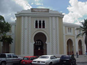
Maestranza de Maracay
http://www.venezuelatuya.com/centro/maracay/plazadetoros.jpg
… And another city from our beautiful Venezuela
For more information about Maracay, visit:
www.venezuelatuya.com/centro/maracay.htm
http://en.wikipedia.org/wiki/Maracay#Higher_Education_Institutions_and_Cultural_Venues
San Juan de los Morros: is the capital of the Guarico state and capital of the Juan Germán Roscio municipality, located in the central south-west of Venezuela. Guarico is the fourth largest state of the country in size but not in population, the density of which is very low. San Juan de los Morros used to be part of Aragua state, but it was exchanged during the 1930´s to Guarico state and was later elevated to Capital of the state, in detriment of former capital Calabozo.
Among the major features of the city are the Statue of San Juan Bautista with 40 meters (131ft) high, the Fransisco Aranda Graduate School and the Lycee (social club) "Juan German Roscio", the Bandera Monument, Bolivar Plaza, the 'Los Morros de San Juan' monument, the historic place and monument known as "La Puerta" (The Gate) and hot springs. The medicinal sulfuric content of the springs makes them a significant tourist attraction.
San Juan de los Morros has a climate of 24 to 32 degrees Celsius and is dominated by the surrounding mountains, which contrasts with the plains of the rest of the state. Typical dishes that originate from the Guarico area are: la cachapa, el pabellón criollo and arepas.
Two of San Juan de los Morros´ most prominent men are Maracay-born Mr. Antonio Barragán (1922-2001) and Mr. Félix Figueroa who have dedicated their lives to the spread of education and literacy across the state.
Morros de San Juan
http://www.curucuteando.com/wp-content/imagenes/2006/08/2006-05-25-San-Juan-de-los-Morros-02.jpg
For more information about San Juan de los Morros, visit:
www.venezuelatuya.com/centro/sanjuan.htm
http://en.wikipedia.org/wiki/San_Juan_De_Los_Morros
Suscribirse a:
Enviar comentarios (Atom)
No hay comentarios:
Publicar un comentario